

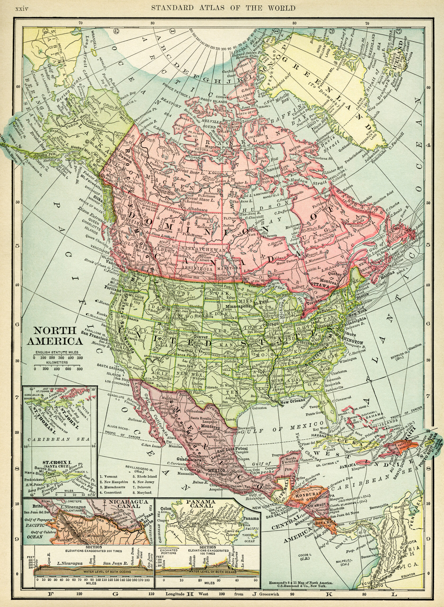
Here is a beautiful old map of North America. Countries included on this map are: Canada, Greenland, United States, Mexico, Guatemala, Honduras, Nicaragua, Costa Rica, Cuba and Haiti. This is a C. S. Hammond map that was printed in one of a two-volume set of dictionaries in my collection that was published in 1906.
Click on image to enlarge.


10 thoughts on “Historical Map of North America”
what a great map – thanks
I’m glad you’re enjoying the maps Elaine. Is there any particular country you’d especially like to see the vintage map of?
Wonderful old Map. Love your offerings so much. 🙂
I’m so pleased to know that, Echo. 🙂
I just discovered you. What a wonderful, and generous site! These maps are terrific. Thanks much!
You’re welcome Ellen. It’s nice to know that you’re enjoying the maps! 🙂
Hi, I’m new to this site and I’m unable to see the north america map on line for some unknown reason, but the main thing is I don’t know how to download the image. Any help will be appreciated. Thanks
Jen,
Please, try again. Can you see it now?
To download it you may click on it – it will open in a new window; then you right-click on the picture and chose to save image.
Hi. Thank you so much for these maps. They are wonderful!
Do you have any map of South America? I’m brazilian.
Isis
You’re welcome for the maps, Isis. I’m happy to know you like them. 🙂
I will check the old dictionary for a map of South America.