

Here is a beautiful old map of Africa. Madagascar, as well as some of the surrounding countries to the north and northwest of Africa are also shown on this antique map. This is a C. S. Hammond map, printed in one of a two-volume set of dictionaries in my collection that was published in 1906.
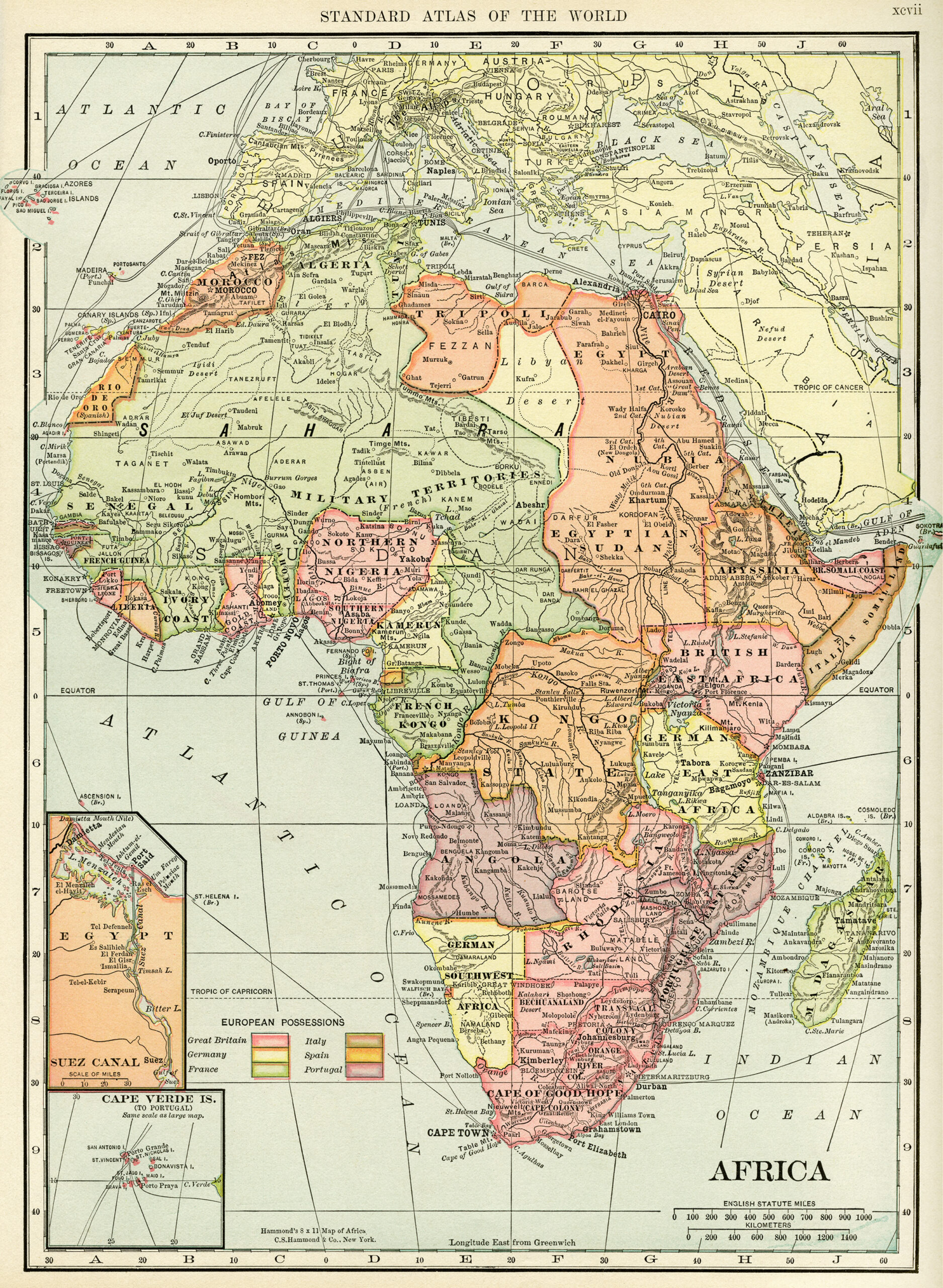
Click on image to enlarge.


4 thoughts on “Historical Geography Map of Africa ~ Free Digital Image”
just LOVE old maps – thanks so much
There are more maps to come. I’m going to try to post at least one each week for the next few weeks.
Hello
Is there anyway I could buy this map to download in a large format?
Hi Nikki,
If you click on the small image in my blog post, a larger format image will open. If you right click with your mouse, it will give you the option to save the image to your computer. That’s the largest size I have available.
Julie