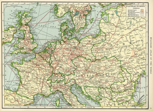
Here is an old map of central Europe. The countries included in full on this map are: France, England, Belgium, Netherlands, Denmark, Germany, Switzerland, Austria Hungary, Bosnia, Servia, Roumania and Bulgaria. Parts of the following countries are also included: Spain, Ireland, Norway, Sweden, Russia, Turkey and Italy. The map is from one of a two-volume set of dictionaries in my collection that was published in 1906.

Click on image to enlarge.


8 thoughts on “Central Europe Vintage Geography Map ~ Free Digital Image”
L-O-V-E old maps – thanks so much
That’s great Elaine! There are several maps in the dictionary and I’ll be adding more. I wish I could work faster because there are so many, many things I want to share. 🙂
Greetings Julie, I would ask you if you can find any map of Europe from year 1878 or early.cheers
thank you
Beautiful!.. I could look at old map for hours… so useful too! Thank you for this 🙂
You’re welcome Angela and Jan. I really enjoy working on the old maps Jan. It gives me the opportunity to enjoy them and I’m happy to be able to share. 🙂
Thank you very much for posting this map.
It’s very interesting to see how different Europe was before WW1. Everything changed afterwords.
You’e welcome Mato. I’m glad you like the map.